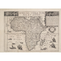
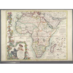
Author: João Teixeira Albernaz I (late 16th century – 1662)
Title: Untitled Sea Chart East Coast of Africa Arabian Peninsula and West Coast of India
Subtitle: Ioão Teixeira cosmographo de sua megestad Afez em Lixboa O Anno de 1649
 Delivery policy
Our remailer uses DHL/Fedex at a fraction of the standard cost. Email us for a quote.
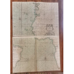
This is an important and seldom available Portuguese sea chart of the eastern coastline of Africa, the Arabian Peninsula and the west coast of India.
Oscar Norwich explained that the chart ‘is extremely important, and its excellence and value are indicated that, more than a century after its compilation, the great cartographer d'Anville (as noted by the geographer Viscount de Santarem) utilized Teixeira substantially for his chart of 1761.’ The chart was the model for not only D’Anville in France, but it was also the model for similar charts (of the ‘western East Indies’) by John Seller in England and Frederick De Wit and Pieter Goos in the Netherlands.
The 1649 manuscript chart by João Teixeira, of which this engraved chart is a faithful copy, is at the French National Library. Teixeira was the royal cosmographer of Portugal. The engraved chart was first published in 1663 by Melchisédec Thévenot, in his important compilation of voyages and related sea charts, Relations de divers Voyages Curieux. The map comes from volume 1 of the book; the English translation of the title of the chapter is: 'Route for the navigation of the East Indies, with descriptions of the islands, Bars, entrances to Ports, & Basses or Banks, the knowledge of which is necessary for Pilots / by Aleixo da Motta, who sailed in these seas for thirty -five years as Pilot Major of the Carracks of Portugal, translated from a Portuguese Manuscript.'
This Portolan chart was important for voyages to and from the Cape of Good Hope, Arabia, and Goa on the west coast of India, an important Portuguese port that was a crucial link to trade with Spice Islands. The rhumb lines and latitude scale down the centre of the chart assisted navigators at sea. Teixeira introduced a phantom island: Roque Piz, at about 6°S and a short distance to the east of the latitude scale; described as three small, flat islands, possibly mistaken for atolls in the Chagos archipelago.
There are insets of the trading posts and harbours on the east coast of Africa that were important along the Portuguese spice route to and from the East Indies: Mozambique, Sofala and Mombasa. There is also an inset of Socotra, off the Horn of Africa, now a UNESCO World Heritage Centre.
Teixeira was one of a renowned Lisbon chart making family and prepared this chart in 1649 manuscript form which is acknowledge at the top right of the chart: João Teixeira Cosmographo. De sua, Magestade. Aféz em Lixboa o Anno de 1649.
The chart is uncoloured, as issued, and in fine condition.
References: Norwich’s Maps of Africa # 305. Not in Tooley.
Dimensions: 50.5 x 68.5 cm.
Date: 1663
Estimate: $5500-$7500
Reserve: $4500
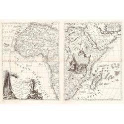
Author: João Teixeira Albernaz I (late 16th century – 1662)
Title: Untitled Sea Chart East Coast of Africa Arabian Peninsula and West Coast of India
Subtitle: Ioão Teixeira cosmographo de sua megestad Afez em Lixboa O Anno de 1649