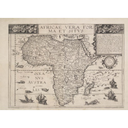
Africa
 Delivery policy
Our remailer uses DHL/Fedex at a fraction of the standard cost. Email us for a quote.
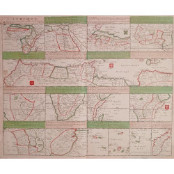
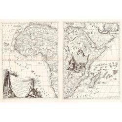
There is no record of a prior sale of this scarce chart by John Thornton & Joel Gascoyne and published c. 1750 by William Mount & Thomas Page. It is a new engraving of part of John Seller's 'Western Ocean.' The 4-sheet, unsigned, undated sea chart depicts part of the Atlantic Ocean and its coastline: to the east, it extends from southern England to the Cape Agulhas, and, to the west, it extends to the northeastern of Brazil extending along the eastern coast as far south as Rio de la Plata.
The chart is a new engraving of John Seller's 'The Western Ocean' (see Norwich #260), but excludes North America and much of South America, retaining only northeastern and eastern Brazil. Tooley listed this chart in his Map Collectors’ Series, No. 61 (#217): dated it 1750 and attributed it to Mount and Page, with no further comment or information.
A single institutional copy of the chart is at the French National Library (FNL), GE SH 18 PF 117 P 29/1). The FNL attributes the chart to John Thornton (1641-1708) and Joel Gascoyne (1650-1705) of the Thames School of Chartmakers – possibly engraved while Thornton & Gascoyne worked from the Signe of the Platt, in the Minories, London.
William Mount and Thomas Page acquired the charts and plates of the Thorntons and of Seller & Price (who reproduced Seller's original 'The Western Ocean', but with their imprint). Mount and Page republished many of the maps, usually deleting the imprint of the original chart makers. The earlier imprint has been erased from both our and the FNL copy of the chart.
The chart comprises two separate 2-sheet parts. It is drawn on Mercator’s projection and there are separate scales of latitude in the Northern and Southern Atlantic Oceans. There is no longitude scale, but it seems the prime meridian is Formigas at the eastern edge of the Azores archipelago.
The cartouche and distance scale are set in Africa, above the Bight of Benin. The distance scale, of 20 Leagues to one degree, is below a scene of four lions above which is an attractive cartouche decorated with two cornucopias and a central basket, all decorated with fruit.
The area covered by this chart was intended for the English East India company whose ships, destined for the Spice Islands, would take a route toward the Cape of Good Hope that usually took advantage of the trade winds and passed close to Dutch-occupied Brazil.
The chart is printed on firm, watermarked paper, has outline colour and a light green wash of the ocean. It is in fine condition.
References: Map Collectors’ Series (No. 61 #217). Not in Tooley’s Collectors’ Guide to Maps of Africa, nor in Norwich’s Maps of Africa.
Publisher: London, Mount and Page
Dimensions: 70 x 51 cm x 2.
Date: ca. 1750
Estimate: $4500-$7500
Reserve: $3250
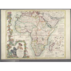
Africa