Home
Subcategories
-
Shrire Collection
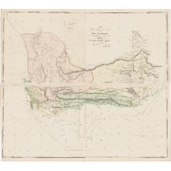
AN AFRICANA MAP COLLECTION RESURFACES
Recently, we've made an exciting announcement regarding the emergence of a remarkable collection of historical significance: a total of 689 maps focusing on Africa, southern Africa, and sea charts depicting the surrounding oceans. These captivating pieces were meticulously curated by R.V. Tooley for David Schrire, a notable figure from South Africa who resided in London during the dynamic decades of the 1960s and 1970s. After being carefully preserved for nearly half a century, this extraordinary collection is now making its debut into the public domain, presenting a unique opportunity for enthusiasts and collectors alike.
Whether one is intrigued by the rich history of Africa, the intricate details of southern Africa, or the navigational marvels captured in sea charts, this collection offers a treasure trove of knowledge and visual splendor. The option to acquire either the entire collection or individual sub-collections (Africa, Southern Africa, and Sea Charts) adds a layer of flexibility to accommodate diverse interests. Through Africana Maps, an esteemed online platform, these exceptionally rare and exclusive items are now accessible, inviting exploration and appreciation from a global audience passionate about historical cartography and cultural heritage.
THE STORY OF THIS COLLECTION'S RETURN
R.V. (Mick) Tooley’s seminal COLLECTORS’ GUIDE to Maps of the African Continent and Southern Africa (London; carta Press, 1969) is dedicated ‘To my friend David Schrire’. Why? Schrire was a South African collector living in exile in London in the 1960s and 1970s. Tooley, a pioneer in the map trade, sought out, described, and sold Africana maps to Schrire. Until he returned to South Africa in the 1970s, Schrire was also Tooley’s patron for the Map Collectors’ Circle (MCC), which published the Map Collectors’ Series (MCS). Schrire returned to South Africa in the early 1970s, leaving the collection in London, with his son Jonathan.
Jonathan returned to South Africa in 1993, with his father's collection intact. The maps have been stored in Cape Town in cabinets (a few in tubes) in a humidity-controlled room. The collection was opened in June 2023, when Jonathan and his wife Gail decided to move to a smaller house in the near future. Less space meant finding a new home for the collection or its three subcollections.
THE COLLECTION
Shrire’s collection may be compared with the Norwich collection, first presented in 1993 in Norwich’s Maps of Africa (Johannesburg; A.D. Donker, 1993 and Vermont: Terra Nova Press, 2003). The table below summarises the collections. Numerous maps are obviously in both the Schrire and Norwich collections. In addition to the maps, the collection includes numerous issues of the MCS and Tooley’s typed records of maps he collected for Schrire.

The Schrire family has decided to sell the entire collection or its subcollections. Duplicate maps and charts, some rarely in the market, will become available on this website. The entire collection has been provisionally catalogued and the catalogue will be made available to potential buyers of the collection or subcollections.

PUBLICATION OF THE COLLECTION
Although the collection has been dormant for almost half a century, many of the maps in the extant collection became known to collectors of Africana maps. In 1963, Tooley authored MCS issue No.6, Early Maps and Views of the Cape of Good Hope, most from Schrire’s collection. In 1965, Schrire described some of these maps in MCS issue No. 17 (Cape of Good Hope 1782 – 1842). Tooley included many more of Schrire’s maps in MCS issues 47 & 48, also included in his COLLECTORS’ GUIDE, and later in MCS issue No. 61. The number of sea charts in Schrire’s collection was a surprise. More than a third of the charts are in neither the MCS nor Norwich. Some of these include scarce charts on navigation by Seller, Thornton, Van Keulen, Robyn and Norie on navigation to and from the Far East.


These maps have been of great interest and this resurfacing has resulted in the sale of a portion of the collection, however, others still remain available to collectors, cartographers and map enthusiasts alike. Click on the button below to view the remaining part of this collection.
-
Africa
-
Southern Africa
-
Cape of Good Hope
The Cape of Good Hope is a jagged headland at Africa’s southern tip, long seen as both a promise and a curse. To sailors, it marked the gateway between two oceans, where ships bound for riches in the East braved monstrous swells, shifting fog, and sudden tempests that could swallow fleets whole. On old maps it appeared as a knife-point jutting into the unknown, a liminal place where Europe’s ambitions collided with nature’s indifference. For centuries it was whispered of as the 'Cape of Storms', a place where compasses faltered, masts splintered, and countless names slipped quietly off the charts into the deep.
-
Central Africa
-
North Africa
-
Rest of World
Active filters
- Availability: Not available